
Evacuation orders along coastlines have been part of common hurricane preparations since the 1950s. Coastal residents also prepare for major storms by building homes elevated above anticipated high water levels, in order to minimize damage and qualify for flood insurance. And building codes commonly call for reinforced construction to endure high wind speeds.
All of these sensible and essential preparations focus on wind and storm surge in coastal zones. Today, however, risk from hurricanes is extending inland. Some of the worst damage from Eastern Seaboard hurricanes in the past several decades has come from inland flooding along rivers after storms move ashore. Hurricane evacuations typically direct coastal residents to retreat inland, but river flooding can put them at risk if shelters and accommodations are not situated safely.
Much of my research, including my book, “Southern Waters: The Limits to Abundance,” has focused on the complex historical geography of water in the American South. What I have seen is that inland river flooding linked to hurricanes and heavy storms is a huge risk in the Southeast, but receives far less attention in emergency plans than coastal areas.
Warm, rainy watersheds
The U.S. Eastern Seaboard is particularly susceptible to river flooding due to tropical weather that moves onshore. From New England to Georgia, a dense network of rivers flows down from the eastern Appalachians across the Piedmont – a broad, rolling plateau extending from the mountains to the coastal plain – and drains into the Atlantic Ocean. Steep gradients move water quickly down the mountain slopes.
On the Piedmont, many small streams merge and then become meandering rivers on the low-lying coastal plain. When tropical weather systems lumber onshore and move inland, they rise up the steep face of the Blue Ridge Mountains. As the saturated air moves upward, it cools and releases huge quantities of rain – a process known as orographic precipitation.
This phenomenon, coupled with heavy rainfall dumped on lower elevations by these tropical systems, unleashes dramatic downpours that funnel into river networks and rush toward the sea, often spilling over the banks of overwhelmed channels.
Planning centers on coastal communities
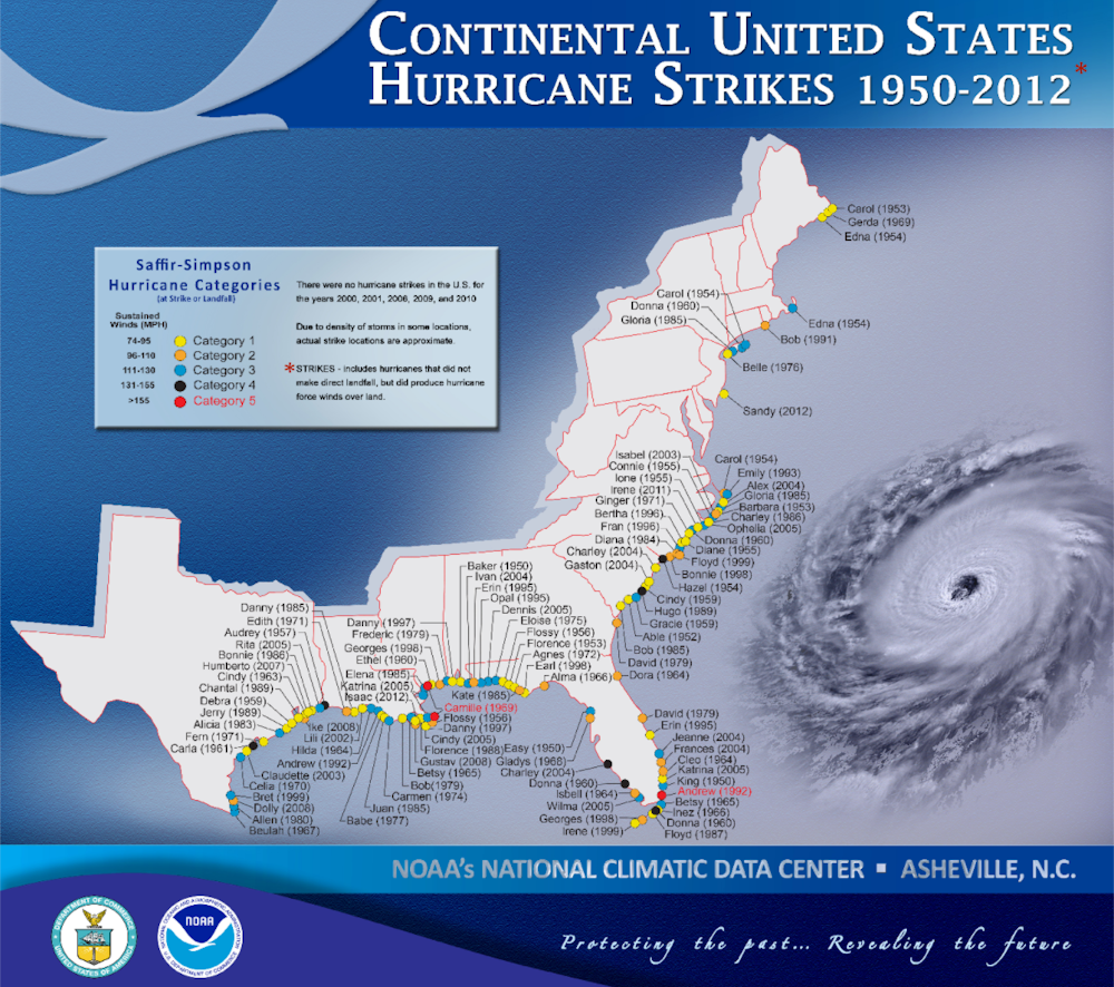
A series of storms in the 1950s prompted federal agencies to start planning for extreme tropical weather events. In August 1954, Hurricane Carol grazed the Outer Banks of North Carolina before battering Long Island and Rhode Island and causing extensive flood damage in New England. Hurricane Edna followed a similar path two weeks later, but remained offshore. And an October storm dumped up to 10 inches of rain across the Appalachians as it moved inland, causing serious flooding, damage and fatalities in Maryland and Pennsylvania.
In 1955 Hurricane Connie unleashed huge amounts of rain over upstate New York. Days later, Hurricane Diane produced modest damage along the coast, but caused extensive river flooding as it continued across New England. Although both of these storms made landfall in North Carolina, their impacts in the more heavily populated northeast spurred federal action.
Following these tragic back-to-back seasons, the U.S. Army Corps of Engineers launched a series of hurricane risk assessments for communities along the Atlantic and Gulf coasts, and the Weather Bureau – the forerunner of the National Weather Service – commenced studying tropical weather systems. The Corps considered building structural protection for most cities, but found that flood walls were too expensive in most locations. Instead, it recommended evacuations, building codes and zoning to limit exposure in areas subject to storm surge – that is, in the immediate coastal zone.
The Weather Bureau issued a model for hurricane planning in 1959 that used a hypothetical community situated directly on the coast. It emphasized effective emergency communication, public education, preparation, and most importantly, evacuation. Neither agency paid any significant attention to inland flooding.
The growing inland threat
Hurricane Floyd in 1999 showed that tropical weather events could wreak havoc inland, mainly through river flooding. Floyd moved onshore near Cape Fear, North Carolina, in mid-September with wind speeds of about 105 miles per hour and traveled northward, dumping up to 20 inches of rain along a path stretching into New England and Canada.
Copious rainfall pushed inland ahead of the storm’s eye overwhelmed most of the rivers in eastern North Carolina. Emergency responders conducted hundreds of inland freshwater rescues. Some river flood crests did not occur until over a week after the storm had passed. Millions of hogs, chickens and other farm animals drowned, and dozens of animal waste lagoons overflowed, contaminating water supplies.
Floyd’s impact was compounded by the fact that it followed Hurricane Dennis by about 10 days, so soils were already saturated. And rivers were still at higher-than-normal stages when Hurricane Irene arrived a month later. Total damage from Floyd alone was estimated at US$6.5 billion, much of it from inland flooding.
Massive floods in Columbia, South Carolina, in 2015 and southeast Louisiana in 2016, caused by rare heavy rainfall events, soaked major urban areas and triggered evacuations – again, mainly through river flooding. And in 2017, Hurricane Harvey dropped at least 52 inches of rain on Houston in six days, an amount NASA described as “unfathomable.”
Prepare inland
As the record shows, places adjacent to the sea are not the only danger zones during hurricanes. Inland river flooding from hurricanes is a major risk, particularly in areas with dense populations. Urban expansion and suburban sprawl have placed more people in areas where no one lived in 1955.
As warmer ocean temperatures contribute to heavier rainfalls and slower moving hurricanes, inland flooding is likely to increase. Until hurricane planning acknowledges this threat, coastal communities will risk evacuating people straight into harm’s way.
- Craig E. Colten Carl O. Sauer Professor of Geography, Louisiana State University
Disclosure statement
Craig E. Colten has received funding from National Academy of Sciences, Louisiana Sea Grant, Minerals Management Service (currently Bureau of Energy Management), U.S. Army Corps of Engineers. Craig E. Colten is a member of the American Association of Geographers.
This post was originally published at The Conversation.


Storms, floods and heavy rainfall can cause enormous amounts of damage to Canadian communities, particularly in British Columbia. When you need assistance with underwater operations, including pipe penetrations, dams or rivers, you need to ensure your commercial diving services provider has the equipment and expertise to inspect, maintain and repair your subsea assets.